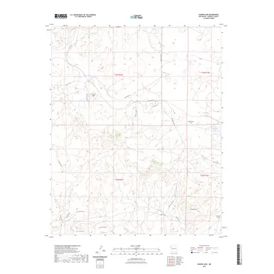
2023 Map of Samson Lake
USGS Topo · Published 2023About this map
Torrivio Ridge and Torrivio Mesa define the high ground of this McKinley County landscape, where the terrain shifts between elevated plateaus and drainage systems like Defiance Draw. The area is marked by a network of local roads and named routes such as Sunset Valley Rd, Sweet Valley Rd, and the Pittsburg Loop, indicating a region utilized for transit and ranching. Water sources are critical landmarks in this arid environment, represented by Samson Lake in the eastern portion and isolated springs like Manuelito Spring, Parker Spring, and those found within Leo Canyon. These features suggest a history of resource management and livestock movement across the high desert flats like Blue Grass Flat.
Find a feature on this map
28 named features on this map. Tap any name to fly to it.
Don’t see what you’re looking for? This feature index may not catch every label — zoom into the map to look around manually.
Map Details
Editions of this 2023 Samson Lake Map
This is the sole edition of this map. No revisions or reprints were ever made.
Other maps of this area

1886 · Wingate
USGS Topo · 1:250,000

1886 · Fort Defiance
USGS Topo · 1:250,000

1892 · Fort Defiance
USGS Topo · 1:250,000

1892 · Wingate
USGS Topo · 1:250,000

1954 · Gallup
USGS Topo · 1:250,000

1955 · Zith-Tusayan Butte 4 NE
USGS Topo · 1:24,000

1958 · Gallup
USGS Topo · 1:250,000

1959 · Gallup
USGS Topo · 1:250,000

1962 · Gallup
USGS Topo · 1:250,000

1963 · Twin Lakes
USGS Topo · 1:24,000