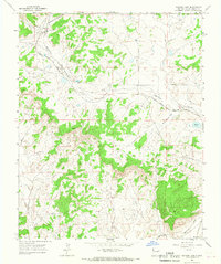
1963 Map of Samson Lake
USGS Topo · Published 1967About this map
Industrial expansion and high-desert terrain define this corner of McKinley County during the early 1960s. The northwest quadrant is dominated by the McKinley Mine and a nearby Strip Mine, with a dedicated Tipple indicating active coal operations. Transportation is centered on the Atchison Topeka and Santa Fe railroad, which snakes through the landscape alongside a prominent Pipeline. Notable natural landmarks include the broad Torrivio Mesa and the drainage of Defiance Draw, which cuts across the central plains toward Samson Lake. To the south, the Puerco River and the uniquely named Burned Through the Rock Wash illustrate the complex hydrology of this arid region. The map captures a moment of heavy industrial infrastructure integrated into a landscape of flats like Blue Grass Flat and scattered mesas.
Find a feature on this map
18 named features on this map. Tap any name to fly to it.
Don’t see what you’re looking for? This feature index may not catch every label — zoom into the map to look around manually.
Map Details
Editions of this 1963 Samson Lake Map
This is the sole edition of this map. No revisions or reprints were ever made.
Other maps of this area

1886 · Wingate
USGS Topo · 1:250,000

1886 · Fort Defiance
USGS Topo · 1:250,000

1892 · Fort Defiance
USGS Topo · 1:250,000

1892 · Wingate
USGS Topo · 1:250,000

1954 · Gallup
USGS Topo · 1:250,000

1955 · Zith-Tusayan Butte 4 NE
USGS Topo · 1:24,000

1958 · Gallup
USGS Topo · 1:250,000

1959 · Gallup
USGS Topo · 1:250,000

1962 · Gallup
USGS Topo · 1:250,000

1963 · Twin Lakes
USGS Topo · 1:24,000