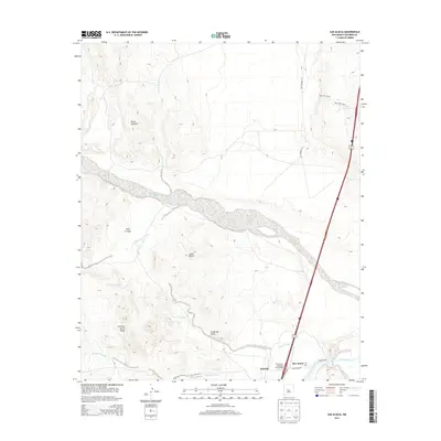
2013 Map of San Acacia
USGS Topo · Published 2013About this map
The Rio Grande and its complex irrigation network define the valley floor in this Socorro County landscape, where the San Acacia Po and Alamillo settlements sit along the river's western bank. This 2013 survey illustrates the critical infrastructure of the high desert, featuring the Alamillo Ditch and the San Acacia Drainage Canal as they manage water through the arid terrain. To the west, the topography rises sharply toward the Sierra Ladrones, a massive uplift that overlooks a series of dry washes such as Arroyo Tio Lino and the broad, sandy expanse of the Rio Salado. The map documents the intersection of modern transport and traditional land use, showing the San Acacia-Polvadera Interchange alongside segments of Old Highway 85. From the high peaks of Loma Blanca to the low-lying Valle Frutosa, the sheet provides an intricate look at the canyon systems and named ridges like Cerritos de las Minas.
Find a feature on this map
22 named features on this map. Tap any name to fly to it.
Don’t see what you’re looking for? This feature index may not catch every label — zoom into the map to look around manually.
Map Details
Editions of this 2013 San Acacia Map
This is the sole edition of this map. No revisions or reprints were ever made.
Other maps of this area

1906 · Socorro
USGS Topo · 1:62,500

1916 · La Joya
USGS Topo · 1:125,000

1952 · La Joya NW
USGS Topo · 1:24,000

1952 · San Anacia
USGS Topo · 1:24,000

1952 · La Joya
USGS Topo · 1:24,000

1952 · Abeytas
USGS Topo · 1:24,000

1954 · Socorro
USGS Topo · 1:250,000

1958 · Socorro
USGS Topo · 1:250,000

1959 · Mesa Del Yeso
USGS Topo · 1:24,000

1959 · Lemitar
USGS Topo · 1:24,000