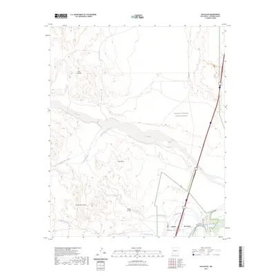
2023 Map of San Acacia
USGS Topo · Published 2023About this map
The confluence of the Rio Grande and the Rio Salado anchor this desert landscape, where water management remains central to the local geography. Human settlement is clustered near the river valley at San Acacia and Alamillo, supported by engineering works like the San Acacia Drainage Canal and the Alamillo Ditch. The presence of the San Acacia Cem near the river bank provides a focal point for genealogical interest in this part of Socorro County.
Find a feature on this map
23 named features on this map. Tap any name to fly to it.
Don’t see what you’re looking for? This feature index may not catch every label — zoom into the map to look around manually.
Map Details
Editions of this 2023 San Acacia Map
This is the sole edition of this map. No revisions or reprints were ever made.
Other maps of this area

1906 · Socorro
USGS Topo · 1:62,500

1916 · La Joya
USGS Topo · 1:125,000

1952 · La Joya NW
USGS Topo · 1:24,000

1952 · San Anacia
USGS Topo · 1:24,000

1952 · La Joya
USGS Topo · 1:24,000

1952 · Abeytas
USGS Topo · 1:24,000

1954 · Socorro
USGS Topo · 1:250,000

1958 · Socorro
USGS Topo · 1:250,000

1959 · Mesa Del Yeso
USGS Topo · 1:24,000

1959 · Lemitar
USGS Topo · 1:24,000