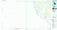
1985 Map of San Ambrosia Creek
USGS Topo · Published 1985About this map
The Rio Grande carves the western boundary of this landscape, marking the international border between United States and Mexico. This 1980s-era planimetric map illustrates a transition from the river's edge into the scrub and ranch lands of South Texas, where water management is the primary driver of development. A dense network of named water features, such as Bueno Agua Tank and Little Lopez Tank, reflects the vital role of artificial impoundments for livestock in this arid environment.
Find a feature on this map
32 named features on this map. Tap any name to fly to it.
Don’t see what you’re looking for? This feature index may not catch every label — zoom into the map to look around manually.
Map Details
Editions of this 1985 San Ambrosia Creek Map
This is the sole edition of this map. No revisions or reprints were ever made.
Other maps of this area

1923 · Palafox
USGS Topo · 1:62,500

1929 · Cotulla
USGS Topo · 1:125,000

1939 · Carrizo Springs
USGS Topo · 1:62,500

1940 · Asherton
USGS Topo · 1:62,500

1940 · San Loranzo Creek
USGS Topo · 1:62,500

1940 · Cometa
USGS Topo · 1:62,500

1940 · Eagle Pass
USGS Topo · 1:62,500

1940 · Chupadera
USGS Topo · 1:62,500

1941 · Botella Creek
USGS Topo · 1:62,500

1953 · Crystal City
USGS Topo · 1:250,000