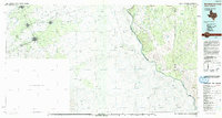
1993 Map of San Ambrosia Creek
USGS Topo · Published 1993About this map
The Rio Grande Rio Bravo Del Norte forms a winding international boundary through this 1993 30x60 minute series sheet, separating the Texas borderlands of Maverick Co, Dimmit Co, and Webb Co from the Mexican state of Coahuila. This cross-border perspective reveals the clustered urban footprints of Zaragoza, Nava, and Allende in Mexico, while the northern bank in the United States is defined by a dendritic network of drainages including San Ambrosia Creek, Juan Botello Creek, and Piedra Creek. The terrain is characterized by intermittent water sources and scrublands, marked by landmarks such as Cathedral Rock and Cathedral Rock Spring. The map provides a rare look at the shared geography of the Rio Grande basin at the end of the twentieth century, documenting the spatial relationship between these neighboring border communities and their shared environment.
Find a feature on this map
19 named features on this map. Tap any name to fly to it.
Don’t see what you’re looking for? This feature index may not catch every label — zoom into the map to look around manually.
Map Details
Editions of this 1993 San Ambrosia Creek Map
2 editions found
Other maps of this area

1923 · Palafox
USGS Topo · 1:62,500

1929 · Cotulla
USGS Topo · 1:125,000

1939 · Carrizo Springs
USGS Topo · 1:62,500

1940 · Asherton
USGS Topo · 1:62,500

1940 · San Loranzo Creek
USGS Topo · 1:62,500

1940 · Cometa
USGS Topo · 1:62,500

1940 · Eagle Pass
USGS Topo · 1:62,500

1940 · Chupadera
USGS Topo · 1:62,500

1941 · Botella Creek
USGS Topo · 1:62,500

1953 · Crystal City
USGS Topo · 1:250,000