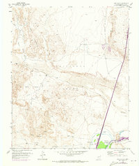
1952 Map of San Anacia
USGS Topo · Published 1973About this map
The confluence of the Rio Salado and Rio Grande dominates this desert landscape, where water management infrastructure defines the local geography. The settlement of San Acacia sits at a critical junction near the Atchison Topeka and Santa Fe railroad, supported by an intricate network of irrigation including the San Acacia Drainage Canal and a complex Drainage Ditch system. To the west, the massive Sierra Ladrones range rises above the Sevilleta Grant, carved by numerous dry washes such as Cañada Popotosa and Arroyo Lino. This 1952 record, updated with 1971 aerial observations, captures a specific era of New Mexican hydraulic engineering, showing the extensive levee systems and gaging stations designed to control the volatile river flows through the Valle Frutosa.
Find a feature on this map
26 named features on this map. Tap any name to fly to it.
Don’t see what you’re looking for? This feature index may not catch every label — zoom into the map to look around manually.
Map Details
Editions of this 1952 San Anacia Map
2 editions found
Other maps of this area

1906 · Socorro
USGS Topo · 1:62,500

1916 · La Joya
USGS Topo · 1:125,000

1952 · La Joya NW
USGS Topo · 1:24,000

1952 · San Anacia
USGS Topo · 1:24,000

1952 · La Joya
USGS Topo · 1:24,000

1952 · Abeytas
USGS Topo · 1:24,000

1954 · Socorro
USGS Topo · 1:250,000

1958 · Socorro
USGS Topo · 1:250,000

1959 · Mesa Del Yeso
USGS Topo · 1:24,000

1959 · Lemitar
USGS Topo · 1:24,000