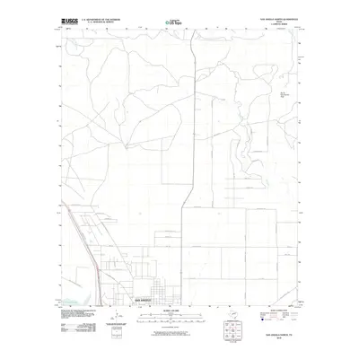
2010 Map of San Angelo North
USGS Topo · Published 2010About this map
San Angelo spreads across the southern portion of this landscape, showing the northward expansion of the city as of 2010. The terrain is defined by the drainage of Red Creek and Bald Eagle Creek, which feed into the northern reaches of O C Fisher Lake. A distinct landmark, Devils Courthouse Peak, rises in the northeast, overlooking a network of rural roads such as Runion Rd and Rust Rd. The map illustrates the transition from the structured urban grid of the city, including N Chadbourne St, to the more dispersed ranch and residential layouts found along FM 2105 and Red Creek Rd. Historical transit corridors are well-marked, with the Old Sterling City Hwy and Old Ballinger Hwy cutting diagonally across the landscape, reflecting the long-established travel routes of Tom Green County.
Find a feature on this map
35 named features on this map. Tap any name to fly to it.
Don’t see what you’re looking for? This feature index may not catch every label — zoom into the map to look around manually.
Map Details
Editions of this 2010 San Angelo North Map
This is the sole edition of this map. No revisions or reprints were ever made.
Other maps of this area

1891 · Hayrick
USGS Topo · 1:125,000

1892 · San Angelo
USGS Topo · 1:125,000

1894 · Hayrick
USGS Topo · 1:125,000

1895 · Sherwood
USGS Topo · 1:125,000

1924 · San Angelo 2-b
USGS Topo · 1:48,000

1924 · Sherwood 1-a
USGS Topo · 1:48,000

1928 · Wall
USGS Topo · 1:62,500

1928 · Tankersly
USGS Topo · 1:62,500

1954 · San Angelo
USGS Topo · 1:250,000

1957 · Carlsbad
USGS Topo · 1:62,500