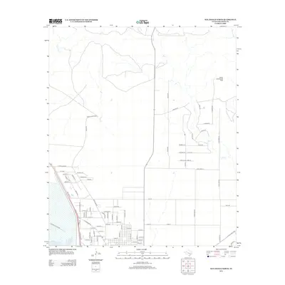
2012 Map of San Angelo North
USGS Topo · Published 2012About this map
O C Fisher Lake anchors the southwestern corner of this West Texas landscape, where the city's Corporate Limit meets a complex network of residential streets and rural corridors. The terrain rises to the north and east, defined by the prominent Devils Courthouse Peak and the drainage systems of Red Cr, Bold Eagle Cr, and Valentine Br. The transition from urban density to ranching and residential acreages is evident in the naming of roads after families and regional history, such as Schwertner Rd and Covington Rd. In the northwest, distinctive thoroughfares like Ute Pass and N Grape Creek Rd provide access to the higher ground, while the Old Ballinger Hwy cuts through the southeastern section, reflecting the historical transportation routes that long preceded the modern suburban expansion.
Find a feature on this map
80 named features on this map. Tap any name to fly to it.
Don’t see what you’re looking for? This feature index may not catch every label — zoom into the map to look around manually.
Map Details
Editions of this 2012 San Angelo North Map
This is the sole edition of this map. No revisions or reprints were ever made.
Other maps of this area

1891 · Hayrick
USGS Topo · 1:125,000

1892 · San Angelo
USGS Topo · 1:125,000

1894 · Hayrick
USGS Topo · 1:125,000

1895 · Sherwood
USGS Topo · 1:125,000

1924 · San Angelo 2-b
USGS Topo · 1:48,000

1924 · Sherwood 1-a
USGS Topo · 1:48,000

1928 · Wall
USGS Topo · 1:62,500

1928 · Tankersly
USGS Topo · 1:62,500

1954 · San Angelo
USGS Topo · 1:250,000

1957 · Carlsbad
USGS Topo · 1:62,500