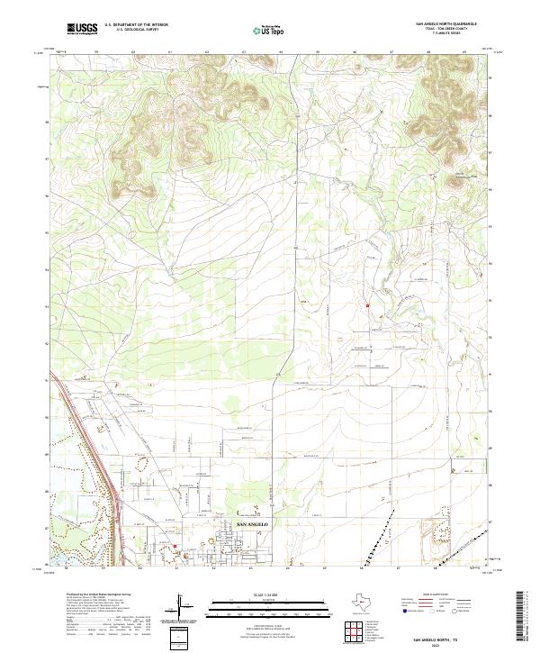
2022 Map of San Angelo North
USGS Topo · Published 2022About this map
San Angelo anchors the southern portion of this modern survey, where the urban grid meets the northern reaches of the Edwards Plateau. The landscape transitions from the developed streets of the city to the expansive reservoir shores of O C Fisher Lake in the southwest. To the north, the terrain becomes more dissected, characterized by the winding courses of Bald Eagle Cr and Red Cr. This area is defined by a mix of ranching infrastructure and contemporary residential expansion, with numerous local roads like Spindle Top Rd and Oilfield Dr reflecting the region's industrial and agricultural history. The northeast is dominated by more prominent relief, culminating in the distinct elevation of Devils Courthouse Peak, a landmark overlooking the surrounding plains and drainage systems.
Find a feature on this map
86 named features on this map. Tap any name to fly to it.
Don’t see what you’re looking for? This feature index may not catch every label — zoom into the map to look around manually.
Map Details
Editions of this 2022 San Angelo North Map
This is the sole edition of this map. No revisions or reprints were ever made.
Other maps of this area

1891 · Hayrick
USGS Topo · 1:125,000

1892 · San Angelo
USGS Topo · 1:125,000

1894 · Hayrick
USGS Topo · 1:125,000

1895 · Sherwood
USGS Topo · 1:125,000

1924 · San Angelo 2-b
USGS Topo · 1:48,000

1924 · Sherwood 1-a
USGS Topo · 1:48,000

1928 · Wall
USGS Topo · 1:62,500

1928 · Tankersly
USGS Topo · 1:62,500

1954 · San Angelo
USGS Topo · 1:250,000

1957 · Carlsbad
USGS Topo · 1:62,500