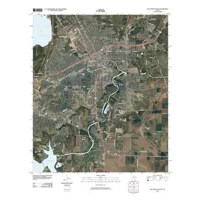
2010 Map of San Angelo South
USGS Topo · Published 2010About this map
San Angelo serves as the focal point of this South Texas survey, where the convergence of the North Concho River, Concho River, and South Concho River dictates the urban and industrial layout. The map documents a complex water management system featuring numerous barriers such as Kirby Dam, Bell Street Dam, and Ben Ficklin Dam, which helped stabilize the region's water supply. Education and history are anchored by Angelo State University and the Angelo Heights Historic District, while the transportation legacy of the city is represented by the Santa Fe Passenger and Freight Depot and the Pat Murphy Bridge.
Find a feature on this map
70 named features on this map. Tap any name to fly to it.
Don’t see what you’re looking for? This feature index may not catch every label — zoom into the map to look around manually.
Map Details
Editions of this 2010 San Angelo South Map
This is the sole edition of this map. No revisions or reprints were ever made.
Other maps of this area

1891 · Hayrick
USGS Topo · 1:125,000

1892 · San Angelo
USGS Topo · 1:125,000

1894 · Hayrick
USGS Topo · 1:125,000

1895 · Sherwood
USGS Topo · 1:125,000

1924 · San Angelo 2-c
USGS Topo · 1:48,000

1924 · Sherwood 1-d
USGS Topo · 1:48,000

1924 · San Angelo 2-b
USGS Topo · 1:48,000

1924 · Sherwood 1-a
USGS Topo · 1:48,000

1928 · Wall
USGS Topo · 1:62,500

1928 · Tankersly
USGS Topo · 1:62,500