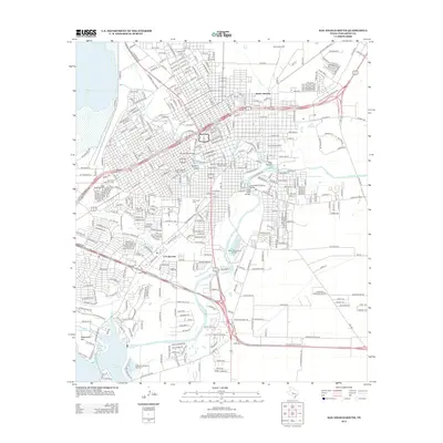
2013 Map of San Angelo South
USGS Topo · Published 2013About this map
Lake Nasworthy and the S Concho River anchor the southern landscape of this 2013 survey, where water management and industrial transit shape the city's growth. The infrastructure of the San Angelo Yard and Alvery Junction highlights the importance of rail logistics, while the Santa Fe Passenger and Freight Depot stands as a central landmark for regional transport history. Residential and historical preservation is evident in the Angelo Heights Historic District, situated near the confluence of the N Concho River and Sulphur Draw.
Find a feature on this map
385 named features on this map. Tap any name to fly to it.
Don’t see what you’re looking for? This feature index may not catch every label — zoom into the map to look around manually.
Map Details
Editions of this 2013 San Angelo South Map
This is the sole edition of this map. No revisions or reprints were ever made.
Other maps of this area

1891 · Hayrick
USGS Topo · 1:125,000

1892 · San Angelo
USGS Topo · 1:125,000

1894 · Hayrick
USGS Topo · 1:125,000

1895 · Sherwood
USGS Topo · 1:125,000

1924 · San Angelo 2-c
USGS Topo · 1:48,000

1924 · Sherwood 1-d
USGS Topo · 1:48,000

1924 · San Angelo 2-b
USGS Topo · 1:48,000

1924 · Sherwood 1-a
USGS Topo · 1:48,000

1928 · Wall
USGS Topo · 1:62,500

1928 · Tankersly
USGS Topo · 1:62,500