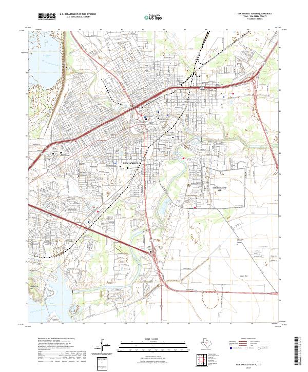
2022 Map of San Angelo South
USGS Topo · Published 2022About this map
The confluence of the North Concho River and South Concho River defines the urban heart of San Angelo, where the city's civic and historical identity is clearly mapped. The historic core is anchored by the Tom Green County Courthouse and the Fort Concho National Historic Landmark, reflecting the community's military origins and its role as a regional seat of government. Residential and institutional expansion is evident across Lipan Flat, with prominent landmarks like Angelo State University and several established cemeteries including Fairmount Cem and Calvary Catholic Cem marking the city's growth.
Find a feature on this map
30 named features on this map. Tap any name to fly to it.
Don’t see what you’re looking for? This feature index may not catch every label — zoom into the map to look around manually.
Map Details
Editions of this 2022 San Angelo South Map
This is the sole edition of this map. No revisions or reprints were ever made.
Other maps of this area

1891 · Hayrick
USGS Topo · 1:125,000

1892 · San Angelo
USGS Topo · 1:125,000

1894 · Hayrick
USGS Topo · 1:125,000

1895 · Sherwood
USGS Topo · 1:125,000

1924 · San Angelo 2-c
USGS Topo · 1:48,000

1924 · Sherwood 1-d
USGS Topo · 1:48,000

1924 · San Angelo 2-b
USGS Topo · 1:48,000

1924 · Sherwood 1-a
USGS Topo · 1:48,000

1928 · Wall
USGS Topo · 1:62,500

1928 · Tankersly
USGS Topo · 1:62,500