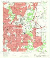
1967 Map of San Antonio East
USGS Topo · Published 1969About this map
Fort Sam Houston dominates the central landscape of eastern San Antonio in the late 1960s, its sprawling grounds and firing ranges serving as a massive military enclave surrounded by rapid urban growth. To the south, the recently developed HemisFair Plaza and the iconic Tower of the Americas represent a modernizing city, while the traditional centers of Alamo Heights and Terrell Hills maintain their distinct corporate boundaries. The rail-heavy industrial corridors are defined by the Missouri - Kansas - Texas and Southern Pacific lines, which cut through neighborhoods filled with local landmarks like Wheatley High Sch and Incarnate Word College. This survey captures the city just as the interstate system, including Interstate 35, began to reshape the flow of traffic around historic parks like Brackenridge Park and the meandering San Antonio River.
Find a feature on this map
91 named features on this map. Tap any name to fly to it.
Don’t see what you’re looking for? This feature index may not catch every label — zoom into the map to look around manually.
Map Details
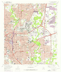
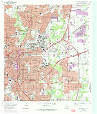
Editions of this 1967 San Antonio East Map
Other maps of this area

1953 · Schertz
USGS Topo · 1:24,000

1953 · San Antonio West
USGS Topo · 1:24,000

1953 · San Antonio East
USGS Topo · 1:24,000

1953 · Terrell Wells
USGS Topo · 1:24,000

1953 · Longhorn
USGS Topo · 1:24,000

1953 · Elmendorf
USGS Topo · 1:24,000

1953 · Southton
USGS Topo · 1:24,000

1953 · Castle Hills
USGS Topo · 1:24,000

1953 · Martinez
USGS Topo · 1:24,000

1954 · San Antonio
USGS Topo · 1:250,000