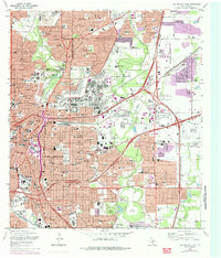
1967 Map of San Antonio East
USGS Topo · Published 1985About this map
San Antonio and its northeast suburbs appear here during a period of significant mid-century expansion, defined by a massive military presence and a dense network of Catholic educational institutions. The map centers on the sprawling grounds of Fort Sam Houston, which includes the National Cemetery and the Brooks Army Medical Center, reflecting the city's identity as a major defense hub. To the west, the historic core is anchored by The Alamo and the extensive City Cemeteries complex near the San Antonio River.
Find a feature on this map
127 named features on this map. Tap any name to fly to it.
Don’t see what you’re looking for? This feature index may not catch every label — zoom into the map to look around manually.
Map Details
Editions of this 1967 San Antonio East Map
Other maps of this area

1953 · Schertz
USGS Topo · 1:24,000

1953 · San Antonio West
USGS Topo · 1:24,000

1953 · San Antonio East
USGS Topo · 1:24,000

1953 · Terrell Wells
USGS Topo · 1:24,000

1953 · Longhorn
USGS Topo · 1:24,000

1953 · Elmendorf
USGS Topo · 1:24,000

1953 · Southton
USGS Topo · 1:24,000

1953 · Castle Hills
USGS Topo · 1:24,000

1953 · Martinez
USGS Topo · 1:24,000

1954 · San Antonio
USGS Topo · 1:250,000