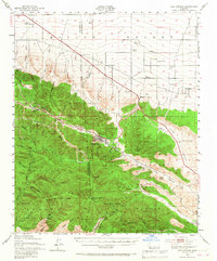
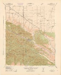
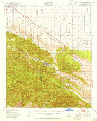
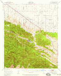
1942 Map of San Antonio
USGS Topo · Published 1967About this map
San Andreas Rift Zone geology dominates this landscape, where the high peaks of the San Gabriel Mountains meet the edge of the Mojave Desert. The mountain community of Wrightwood sits nestled in the Swarthout Valley, while the desert floor to the north is dotted with early 20th-century outposts such as Smith Ranch, Kunzel Ranch, and Phelan. This 1940s-era data reveals a remote network of trails and roads providing access to the rugged heights of Mt San Antonio (Old Baldy) via the Devils Backbone. Industrial history is represented by the Big Horn Mine near Mine Gulch, while scientific interest is marked by the Smithsonian Observatory. The map also captures several recreation sites, including Jackson Lake and the Big Pines Recreation Area, serving as early escapes for those traveling through Cajon Canyon or along Cajon Road.
Find a feature on this map
78 named features on this map. Tap any name to fly to it.
Don’t see what you’re looking for? This feature index may not catch every label — zoom into the map to look around manually.
Map Details
Editions of this 1942 San Antonio Map
4 editions found
Other maps of this area

1894 · Pomona
USGS Topo · 1:62,500

1896 · San Bernardino
USGS Topo · 1:62,500

1897 · Pomona
USGS Topo · 1:62,500

1897 · Cucamonga
USGS Topo · 1:62,500

1898 · Pomona
USGS Topo · 1:62,500

1898 · San Bernardino
USGS Topo · 1:62,500

1900 · Cucamonga
USGS Topo · 1:62,500

1901 · Southern California Sheet No. 1
USGS Topo · 1:250,000

1901 · San Bernardino
USGS Topo · 1:62,500

1902 · Hesperia
USGS Topo · 1:62,500