
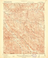
1919 Map of San Benito
USGS Topo · Published 1919About this map
The San Benito River carves a deep valley through the high country of the Gabilan Mountains in this early twentieth-century survey. The landscape reflects a ranching and mining economy, where isolated outposts like Butts Ranch, Grogan Ranch, and Los Muertos Ranch anchor the remote canyons. This era shows a network of rural education, with the Willow Creek School, Cottonwood School, and Antelope School serving the scattered families of the Real De Las Aguilas land grant.
Find a feature on this map
31 named features on this map. Tap any name to fly to it.
Don’t see what you’re looking for? This feature index may not catch every label — zoom into the map to look around manually.
Map Details
Editions of this 1919 San Benito Map
2 editions found
Other maps of this area

1913 · Panoche
USGS Topo · 1:125,000

1915 · Soledad
USGS Topo · 1:62,500

1915 · Priest Valley
USGS Topo · 1:125,000

1919 · Hollister
USGS Topo · 1:48,000

1921 · Gonzales
USGS Topo · 1:62,500

1921 · Metz
USGS Topo · 1:62,500

1921 · Hollister
USGS Topo · 1:62,500

1922 · Quien Sabe
USGS Topo · 1:62,500

1923 · Hollister
USGS Topo · 1:62,500

1931 · San Benito
USGS Topo · 1:62,500