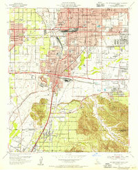
1954 Map of San Bernardino South
USGS Topo · Published 1955About this map
San Bernardino and its southern neighbors show a landscape of rapid mid-century growth and deep-rooted community institutions in this 1954 survey. The map details a heavy concentration of educational and medical facilities, from the College of Medical Evangelists in Loma Linda to the San Bernardino Valley College near the confluence of Warm Creek and Lytle Creek. Transportation infrastructure dominates the valley floor, featuring the extensive yards of the Atchison Topeka and Santa Fe and the Southern Pacific railroads. Significant industrial and military presence is anchored by Norton Air Force Base and the mining activity at Slover Mtn near Colton. Smaller settlements like Grand Terrace and Highgrove are nestled against the La Loma Hills, while historic sites like the Agua Mansa Cemetery reflect the area's older heritage along the Santa Ana River.
Find a feature on this map
73 named features on this map. Tap any name to fly to it.
Don’t see what you’re looking for? This feature index may not catch every label — zoom into the map to look around manually.
Map Details
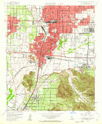
Editions of this 1954 San Bernardino South Map
2 editions found
Other maps of this area

1896 · San Bernardino
USGS Topo · 1:62,500

1898 · San Bernardino
USGS Topo · 1:62,500

1899 · Redlands
USGS Topo · 1:62,500

1901 · Southern California Sheet No. 1
USGS Topo · 1:250,000

1901 · San Bernardino
USGS Topo · 1:62,500

1901 · Redlands
USGS Topo · 1:62,500

1901 · Elsinore
USGS Topo · 1:125,000

1901 · Riverside
USGS Topo · 1:62,500

1904 · Southern California Sheet No. 1
USGS Topo · 1:250,000

1936 · Devore
USGS Topo · 1:31,680