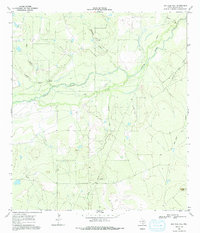
1969 Map of San Caja Hill
USGS Topo · Published 1991About this map
The Nueces River winds through this South Texas landscape, creating a complex network of active and relic channels including the Old River. This 1969 field survey reveals a sparsely populated terrain where the local economy is defined by natural resource extraction and aviation, centered around the Ezzell Oil Field and a nearby Landing Strip. The topographic relief is punctuated by family-named landmarks like Drakes Point and the prominent San Caja Hill, which rises above the surrounding scrub and drainage systems.
Find a feature on this map
15 named features on this map. Tap any name to fly to it.
Don’t see what you’re looking for? This feature index may not catch every label — zoom into the map to look around manually.
Map Details
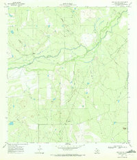
Editions of this 1969 San Caja Hill Map
2 editions found
Other maps of this area

1920 · Mikeska
USGS Topo · 1:125,000

1925 · Simmons No. 1
USGS Topo · 1:48,000

1925 · Tilden No. 1
USGS Topo · 1:48,000

1925 · Simmons No. 2
USGS Topo · 1:48,000

1929 · Simmons
USGS Topo · 1:62,500

1930 · Tilden
USGS Topo · 1:62,500

1937 · Loma Alta
USGS Topo · 1:62,500

1942 · Tilden
USGS Topo · 1:62,500

1953 · Crystal City
USGS Topo · 1:250,000

1955 · Crystal City
USGS Topo · 1:250,000