1980 Map of San Clemente Island
USGS Topo · Published 1980About this map
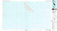
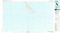
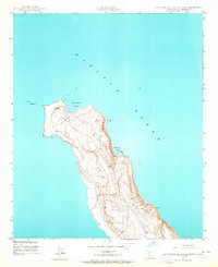
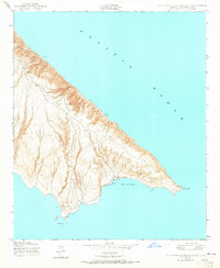
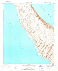
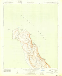
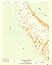
San Clemente Island stands isolated in the southern California waters of Los Angeles County, revealing a landscape heavily shaped by its mid-century role as a military installation. By the 1980s, the island's topography was defined by the Naval Ocean Systems Center Island Facility and its associated Landing Strip, underscoring its strategic importance for oceanic research and naval operations. The rugged coastline is punctuated by descriptive landmarks such as Eel Pt, Mail Pt, and Lost Pt, leading down to the broad southern curve of Pyramid Cove. Flanked by the Outer Santa Barbara Passage and the Gulf of Santa Catalina, the map illustrates a unique intersection of military infrastructure and natural coastal features, including the distinctive Balanced Rock and the terminal southern tip at Pyramid Head.
Find a feature on this map
15 named features on this map. Tap any name to fly to it.
Don’t see what you’re looking for? This feature index may not catch every label — zoom into the map to look around manually.
Map Details
Editions of this 1980 San Clemente Island Map
2 editions found
Other maps of this area

1902 · Capistrano
USGS Topo · 1:125,000

1906 · Capistrano
USGS Topo · 1:125,000
1943 · San Clemente Island North
USGS Topo · 1:24,000
1943 · San Clemente Island South
USGS Topo · 1:24,000
1943 · San Clemente Island Central
USGS Topo · 1:24,000

1947 · Santa Ana
USGS Topo · 1:250,000

1949 · Long Beach
USGS Topo · 1:250,000

1949 · Santa Ana
USGS Topo · 1:250,000
1950 · San Clemente Island North
USGS Topo · 1:24,000
1950 · San Clemente Island Central
USGS Topo · 1:24,000