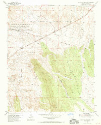
1954 Map of San Felipe Pueblo NE
USGS Topo · Published 1969About this map
El Camino Real cuts across this high desert landscape, tracing a historical path that predates the modern infrastructure of the mid-20th century. This 1954 survey captures the overlap of ancient tribal lands and early American westward expansion, marking the Santo Domingo Pueblo Grant and the San Felipe Indian Reservation. The geography is defined by deep drainage systems like the Arroyo de la Vega de los Tanos and Arroyo del Tuerto, which channel seasonal water toward the Rio Grande valley just beyond these borders.
Find a feature on this map
22 named features on this map. Tap any name to fly to it.
Don’t see what you’re looking for? This feature index may not catch every label — zoom into the map to look around manually.
Map Details
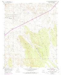
Editions of this 1954 San Felipe Pueblo NE Map
3 editions found
Other maps of this area

1892 · San Pedro
USGS Topo · 1:125,000

1892 · Santa Clara
USGS Topo · 1:125,000

1953 · Santo Domingo Pueblo
USGS Topo · 1:24,000

1953 · Tetilla Peak
USGS Topo · 1:24,000

1953 · Santo Domingo Pueblo SW
USGS Topo · 1:24,000

1953 · Agua Fria
USGS Topo · 1:62,500

1953 · Santo Domingo Pueblo
USGS Topo · 1:62,500

1954 · San Felipe Pueblo
USGS Topo · 1:24,000

1954 · Placitas
USGS Topo · 1:24,000

1954 · San Felipe Pueblo NE
USGS Topo · 1:24,000