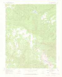
1969 Map of San Isabel
USGS Topo · Published 1973About this map
San Isabel sits at the intersection of recreation and rugged elevation within the San Isabel National Forest, where the convergence of Custer, Pueblo, and Huerfano counties meets the high peaks. The 1960s landscape is defined by the headwaters of the Saint Charles River and the prominent Greenhorn Mountain massif, which reaches 12,347 feet at its summit. Human activity is centered around the shore of Lake Isabel, where a campground, picnic area, and the Graham Memorial Park reflect the area's established role as a mountain retreat. A network of pack trails, including the Saint Charles Trail and Bartlett Trail, provides the primary access to the higher backcountry reaches such as North Peak and Snowslide Canyon. Further south, Camp Crockett and Lazy Acres Camp mark localized settlements, while various springs like Rooster Spring suggest the critical importance of water sources in this alpine terrain.
Find a feature on this map
40 named features on this map. Tap any name to fly to it.
Don’t see what you’re looking for? This feature index may not catch every label — zoom into the map to look around manually.
Map Details
Editions of this 1969 San Isabel Map
2 editions found
Other maps of this area

1889 · Canon City
USGS Topo · 1:125,000

1889 · Huerfano Park
USGS Topo · 1:125,000

1891 · Walsenburg
USGS Topo · 1:125,000

1891 · Pueblo
USGS Topo · 1:125,000

1892 · Huerfano Park
USGS Topo · 1:125,000

1892 · Canon City
USGS Topo · 1:125,000

1894 · Walsenburg
USGS Topo · 1:125,000

1894 · Pueblo
USGS Topo · 1:125,000

1896 · Pueblo
USGS Topo · 1:125,000

1897 · Pueblo
USGS Topo · 1:125,000