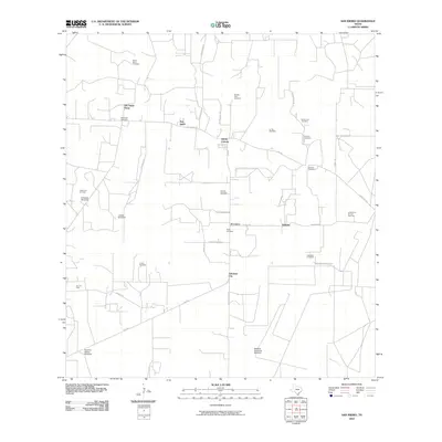
2010 Map of San Isidro
USGS Topo · Published 2010About this map
San Isidro and the surrounding South Texas brushlands are defined by a complex network of ranching roads and small, family-associated settlements. The landscape is heavily marked by heritage, with numerous burial sites such as the Santa Elena Cemetery, Montalvo Cemetery, and Rancho Viejo Cemetery serving as vital landmarks for genealogists and local historians. This era shows a community structured around rural life and the petroleum industry, evidenced by the North Sun Oil Field and the La Reforma Oil and Gas Field.
Find a feature on this map
40 named features on this map. Tap any name to fly to it.
Don’t see what you’re looking for? This feature index may not catch every label — zoom into the map to look around manually.
Map Details
Editions of this 2010 San Isidro Map
This is the sole edition of this map. No revisions or reprints were ever made.
Other maps of this area

1938 · Agua Nueva
USGS Topo · 1:62,500

1938 · Sal Colorada
USGS Topo · 1:62,500

1939 · La Reforma
USGS Topo · 1:62,500

1939 · Encantada
USGS Topo · 1:62,500

1949 · Mc Allen
USGS Topo · 1:250,000

1954 · McAllen
USGS Topo · 1:250,000

1957 · Mc Allen
USGS Topo · 1:250,000

1962 · McAllen
USGS Topo · 1:250,000
1972 · Santa Elena SE
USGS Topo · 1:24,000
1972 · San Isidro
USGS Topo · 1:24,000