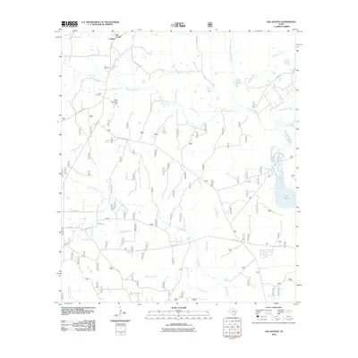
2010 Map of San Jacinto
USGS Topo · Published 2010About this map
Goshen and the surrounding woodlands of East Texas are defined by an intricate network of tributaries feeding the West Fork San Jacinto River. This landscape, documented in the early 21st century, showcases a mix of rural settlement and managed forest lands, with Forest Service 208 RD and Forest Service 209 RD providing access through the timber. Local history is anchored by the Lee Cemetery and Farris Cemetery, which sit near the winding paths of Lee Branch and West Sandy Creek. The presence of the Pool Lookout suggests the critical role of fire observation in this heavily forested region. Water dominates the eastern edge of the quadrangle, where Lake Paula and various branches like McDonald Creek and Robinson Creek drain toward the river basin.
Find a feature on this map
33 named features on this map. Tap any name to fly to it.
Don’t see what you’re looking for? This feature index may not catch every label — zoom into the map to look around manually.
Map Details
Editions of this 2010 San Jacinto Map
This is the sole edition of this map. No revisions or reprints were ever made.
Other maps of this area

1954 · Beaumont
USGS Topo · 1:250,000

1957 · Beaumont
USGS Topo · 1:250,000

1958 · Lake Paula
USGS Topo · 1:24,000

1959 · Moore Grove
USGS Topo · 1:24,000

1959 · San Jacinto
USGS Topo · 1:24,000

1959 · Montgomery
USGS Topo · 1:24,000

1962 · Dacus
USGS Topo · 1:24,000

1962 · Richards
USGS Topo · 1:24,000

1962 · Galilee
USGS Topo · 1:24,000
1963 · Loma
USGS Topo · 1:24,000