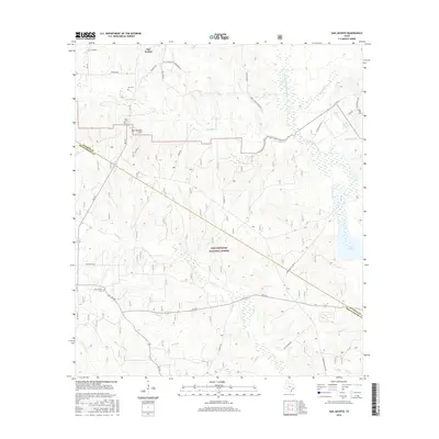
2016 Map of San Jacinto
USGS Topo · Published 2016About this map
The Sam Houston National Forest dominates this section of East Texas, where the landscape is defined by the dense drainage network of the W Fork San Jacinto River. Settlement patterns are concentrated around historical community hubs such as San Jacinto and Farris, often marked by family and community burial grounds like Union Grove Cem and Lee Cem. The topography is generally subtle, punctuated by landmarks such as Blue Bonnet Hill and the western reaches of Lake Conroe.
Find a feature on this map
41 named features on this map. Tap any name to fly to it.
Don’t see what you’re looking for? This feature index may not catch every label — zoom into the map to look around manually.
Map Details
Editions of this 2016 San Jacinto Map
This is the sole edition of this map. No revisions or reprints were ever made.
Other maps of this area

1954 · Beaumont
USGS Topo · 1:250,000

1957 · Beaumont
USGS Topo · 1:250,000

1958 · Lake Paula
USGS Topo · 1:24,000

1959 · Moore Grove
USGS Topo · 1:24,000

1959 · San Jacinto
USGS Topo · 1:24,000

1959 · Montgomery
USGS Topo · 1:24,000

1962 · Dacus
USGS Topo · 1:24,000

1962 · Richards
USGS Topo · 1:24,000

1962 · Galilee
USGS Topo · 1:24,000
1963 · Loma
USGS Topo · 1:24,000