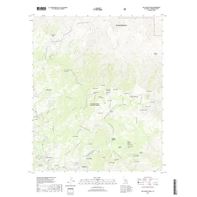
2018 Map of San Jacinto Peak
USGS Topo · Published 2018About this map
Idyllwild and Fern Valley anchor the southwestern corner of this survey, representing the high-elevation residential and resort clusters within the San Bernardino National Forest. The landscape is dominated by the massive granite uplift of the San Jacinto Mountains, culminating at San Jacinto Peak. This area is a critical node for recreational infrastructure, featuring an extensive network of footpaths including the Pacific Crest National Scenic Trail and the Deer Springs Trail. The map reveals the intricate water systems that drain these heights, from the N Fork San Jacinto River to the steep drops of Snow Cr and Falls Cr. Unusual alpine features like Hidden Lake and the high-altitude meadows of Tahquitz Meadow and Reeds Meadow highlight the unique montane ecology. To the northeast, the terrain falls away toward Palm Springs, showing the dramatic vertical relief between the desert floor and the wooded ridges of One Horse Ridge and Fuller Ridge.
Find a feature on this map
92 named features on this map. Tap any name to fly to it.
Don’t see what you’re looking for? This feature index may not catch every label — zoom into the map to look around manually.
Map Details
Editions of this 2018 San Jacinto Peak Map
This is the sole edition of this map. No revisions or reprints were ever made.
Other maps of this area

1901 · Southern California Sheet No. 1
USGS Topo · 1:250,000

1901 · San Jacinto
USGS Topo · 1:125,000

1904 · Southern California Sheet No. 1
USGS Topo · 1:250,000

1940 · Palm Springs
USGS Topo · 1:62,500

1940 · Hemet Reservoir
USGS Topo · 1:62,500

1942 · Banning
USGS Topo · 1:62,500

1942 · Hemet Reservoir
USGS Topo · 1:62,500

1942 · Hemet
USGS Topo · 1:62,500

1943 · Hemet
USGS Topo · 1:62,500

1943 · Banning
USGS Topo · 1:62,500
Featured Places
- Palm Springs, CA
- Pine Wood, CA
- Pine Cove, Idyllwild-Pine Cove
- Idyllwild-Pine Cove, CA
- Fern Valley, Idyllwild-Pine Cove