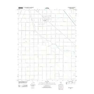
2012 Map of San Joaquin
USGS Topo · Published 2012About this map
San Joaquin serves as the central hub of this agricultural landscape in Fresno County, organized around a dense grid of rural roads and irrigation systems. The settlement's connection to regional logistics is anchored by W Railroad Ave and the central Po, while the surrounding terrain is defined by the winding path of the Fresno Slough. This watercourse, along with the Beta Canal, illustrates the critical role of water management in the Central Valley, with many of the local thoroughfares like W Manning Ave and Colorado Rd following the established section lines of the valley's vast farming tracts. The map reveals the intricate network of family-named roads, such as S El Dorado Ave and S Yolo Ave, which delineate the expansive fields and orchards that dominate the area from W Mountain View Ave south to W Clarkson Ave.
Find a feature on this map
41 named features on this map. Tap any name to fly to it.
Don’t see what you’re looking for? This feature index may not catch every label — zoom into the map to look around manually.
Map Details
Editions of this 2012 San Joaquin Map
This is the sole edition of this map. No revisions or reprints were ever made.
Other maps of this area

1912 · Coalinga
USGS Topo · 1:125,000

1923 · Englebrecht Ranch
USGS Topo · 1:31,680

1924 · Jamesan
USGS Topo · 1:31,680

1924 · Tranquillity
USGS Topo · 1:31,680

1925 · Helm
USGS Topo · 1:31,680

1925 · San Joaquin
USGS Topo · 1:31,680

1931 · Wheatville
USGS Topo · 1:31,680

1931 · Towne Oil Station
USGS Topo · 1:31,680

1931 · Mouth of Cantua Creek
USGS Topo · 1:31,680

1943 · Joaquin Rocks
USGS Topo · 1:62,500