
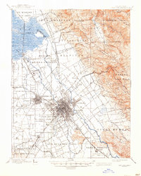
1889 Map of San Jose
USGS Topo · Published 1939About this map
The Santa Clara Valley unfolds in this 1895 survey as a landscape of Spanish land grants and nascent rail towns centered on San Jose. Large tracts like Yerba Buena and Rinconada de los Gatos define the rural stretches between established hubs. The Southern Pacific R. R. serves as the backbone of transport, with several spurs including the Almaden Branch and San Jose Branch connecting agricultural and mining outposts.
Find a feature on this map
68 named features on this map. Tap any name to fly to it.
Don’t see what you’re looking for? This feature index may not catch every label — zoom into the map to look around manually.
Map Details
Editions of this 1889 San Jose Map
2 editions found
Other maps of this area

1897 · San Jose
USGS Topo · 1:62,500

1897 · Mt. Hamilton
USGS Topo · 1:62,500

1897 · Palo Alto
USGS Topo · 1:62,500

1899 · San Jose
USGS Topo · 1:62,500

1899 · Palo Alto
USGS Topo · 1:62,500

1899 · Haywards
USGS Topo · 1:62,500

1902 · Santa Cruz
USGS Topo · 1:125,000

1906 · Pleasanton
USGS Topo · 1:62,500

1907 · Tesla
USGS Topo · 1:62,500

1915 · Haywards
USGS Topo · 1:62,500