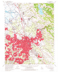
1961 Map of San Jose
USGS Topo · Published 1967About this map
San Jose and its burgeoning suburbs dominate this mid-century landscape, showing the transition from an agricultural valley into a major urban center. The city core is surrounded by historic land grants like Pueblo de San Jose and Potrero de Santa Clara, while the industrial expansion of the 1960s is evident in the sprawling residential tracts and new highway networks. Along the northern edge, Salt Evaporators line the Alviso Slough near the historic port of Alviso, where the Southern Pacific and Western Pacific railroads converge.
Find a feature on this map
145 named features on this map. Tap any name to fly to it.
Don’t see what you’re looking for? This feature index may not catch every label — zoom into the map to look around manually.
Map Details
Editions of this 1961 San Jose Map
2 editions found
Other maps of this area

1889 · San Jose
USGS Topo · 1:62,500

1897 · San Jose
USGS Topo · 1:62,500

1897 · Mt. Hamilton
USGS Topo · 1:62,500

1897 · Palo Alto
USGS Topo · 1:62,500

1899 · San Jose
USGS Topo · 1:62,500

1899 · Palo Alto
USGS Topo · 1:62,500

1899 · Haywards
USGS Topo · 1:62,500

1902 · Santa Cruz
USGS Topo · 1:125,000

1906 · Pleasanton
USGS Topo · 1:62,500

1907 · Tesla
USGS Topo · 1:62,500