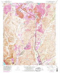
1968 Map of San Juan Capistrano
USGS Topo · Published 1981About this map
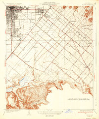
The Atchison Topeka and Santa Fe railroad corridor and the San Diego Freeway define the rapid suburban transformation of southern Orange County as it appeared in the late 1960s. In the north, Laguna Hills and Mission Viejo show significant residential expansion, including the Leisure World Golf Club. This 1981 update uses purple tinting to distinguish newer urban growth from the earlier 1968 landscape, highlighting the encroachment of development into the Sheep Hills and Cañada de los Alisos. Near the southern edge, the historic settlement of San Juan Capistrano remains a focal point, situated near the confluence of Arroyo Trabuco and San Juan Creek. The map records essential community infrastructure of the era, from the Mission Viejo High Sch to the Sulphur Creek Reservoir, while preserving the locations of older landmarks like the Mission Cem and various gaging stations along the drainage basins.
Find a feature on this map
37 named features on this map. Tap any name to fly to it.
Don’t see what you’re looking for? This feature index may not catch every label — zoom into the map to look around manually.
Map Details
Editions of this 1968 San Juan Capistrano Map
4 editions found
Other maps of this area

1896 · Santa Ana
USGS Topo · 1:62,500

1901 · Southern California Sheet No. 1
USGS Topo · 1:250,000

1901 · Santa Ana
USGS Topo · 1:62,500

1902 · Capistrano
USGS Topo · 1:125,000

1902 · Corona
USGS Topo · 1:125,000

1904 · Southern California Sheet No. 2
USGS Topo · 1:250,000

1904 · Southern California Sheet No. 1
USGS Topo · 1:250,000

1906 · Capistrano
USGS Topo · 1:125,000

1932 · Tustin
USGS Topo · 1:31,680
1935 · Tustin
USGS Topo · 1:31,680