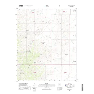
2020 Map of San Juan Peak
USGS Topo · Published 2020About this map
Cibola National Forest encompasses the high-desert terrain of this Socorro County quadrangle, defined by a series of deep canyons and prominent ridges. Rising above the landscape, San Juan Peak serves as a central landmark, flanked by the steep walls of San Juan Canyon and the surrounding Tonto Basin. The map reveals a complex network of dry watercourses, including Rattlesnake Canyon and Eaton Canyon, which carve through the volcanic and sedimentary geology of the region.
Find a feature on this map
51 named features on this map. Tap any name to fly to it.
Don’t see what you’re looking for? This feature index may not catch every label — zoom into the map to look around manually.
Map Details
Editions of this 2020 San Juan Peak Map
This is the sole edition of this map. No revisions or reprints were ever made.
Other maps of this area

1954 · Tularosa
USGS Topo · 1:250,000

1958 · Tularosa
USGS Topo · 1:250,000

1961 · Hickman Ranch
USGS Topo · 1:24,000

1961 · Black Hill
USGS Topo · 1:24,000

1964 · Vicks Peak
USGS Topo · 1:24,000

1964 · San Juan Peak
USGS Topo · 1:24,000

1964 · Blue Mountain
USGS Topo · 1:24,000

1964 · Steel Hill
USGS Topo · 1:24,000
1964 · Grassy Lookout
USGS Topo · 1:24,000
1965 · Tenmile Hill
USGS Topo · 1:24,000