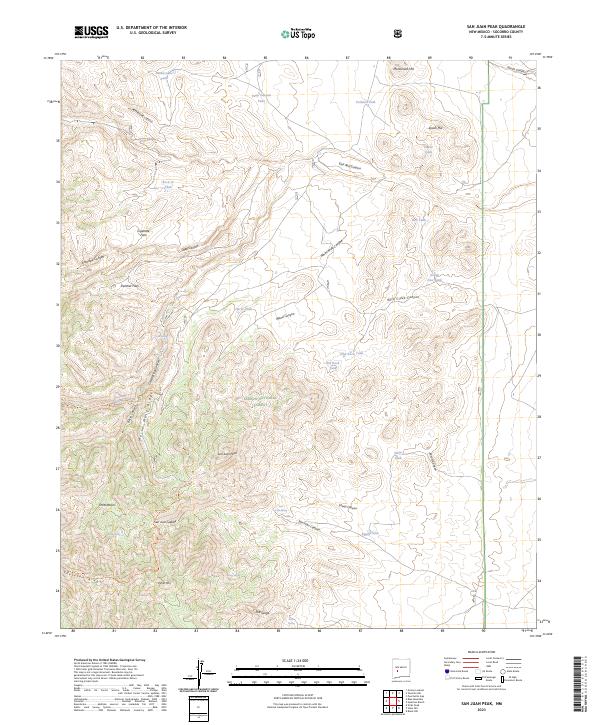
2023 Map of San Juan Peak
USGS Topo · Published 2023About this map
San Juan Peak rises as the central landmark in this high-elevation reach of Socorro County, where the southern reaches of the Cibola National Forest meet the protected expanse of the Apache Kid Wilderness. The landscape is defined by its complex hydrology, with numerous named tanks and springs like Rattlesnake Tank, Junction Spring, and San Juan Spring indicating the vital importance of water management in this arid environment. The terrain is marked by distinct geological formations, from the flat mesas of Panther Flats and Cigarette Flats to the dramatic descent into The Gorge at the southern edge of the sheet.
Find a feature on this map
52 named features on this map. Tap any name to fly to it.
Don’t see what you’re looking for? This feature index may not catch every label — zoom into the map to look around manually.
Map Details
Editions of this 2023 San Juan Peak Map
This is the sole edition of this map. No revisions or reprints were ever made.
Other maps of this area

1954 · Tularosa
USGS Topo · 1:250,000

1958 · Tularosa
USGS Topo · 1:250,000

1961 · Hickman Ranch
USGS Topo · 1:24,000

1961 · Black Hill
USGS Topo · 1:24,000

1964 · Vicks Peak
USGS Topo · 1:24,000

1964 · San Juan Peak
USGS Topo · 1:24,000

1964 · Blue Mountain
USGS Topo · 1:24,000

1964 · Steel Hill
USGS Topo · 1:24,000
1964 · Grassy Lookout
USGS Topo · 1:24,000
1965 · Tenmile Hill
USGS Topo · 1:24,000