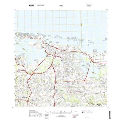
2018 Map of San Juan
USGS Topo · Published 2018About this map
San Juan National Historic Site and the historic Isleta de San Juan define the northern coastline of this modern metropolitan survey. The capital city and surrounding municipalities of Cataño, Guaynabo, Carolina, and Trujillo Alto are shown in high detail, illustrating a dense urban landscape connected by a complex network of expressways, including the Expreso Las Americas and Expreso de Diego. Educational and medical institutions such as the Universidad de Puerto Rico Recinto de Rio Piedras and the Universidad de Puerto Rico Recinto de Ciencias Medicas reflect the area's role as a regional hub.
Find a feature on this map
123 named features on this map. Tap any name to fly to it.
Don’t see what you’re looking for? This feature index may not catch every label — zoom into the map to look around manually.
Map Details
Editions of this 2018 San Juan Map
This is the sole edition of this map. No revisions or reprints were ever made.
Other maps of this area

1940 · Carolina
USGS Topo · 1:30,000

1941 · Bayamon
USGS Topo · 1:30,000

1941 · San Juan
USGS Topo · 1:30,000

1941 · Carolina
USGS Topo · 1:30,000

1946 · Aguas Buenas
USGS Topo · 1:30,000

1946 · Naranjito
USGS Topo · 1:30,000

1946 · Gurabo
USGS Topo · 1:30,000

1947 · Carolina
USGS Topo · 1:30,000

1947 · Aguas Buenas NO
USGS Topo · 1:10,000

1947 · Bayamon
USGS Topo · 1:30,000