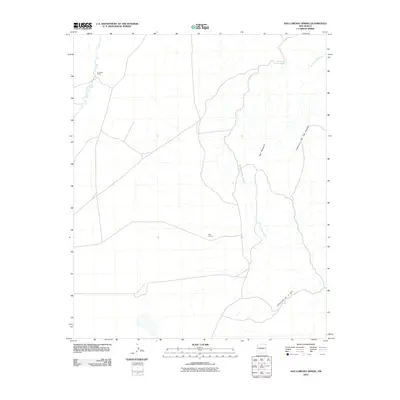
2010 Map of San Lorenzo Spring
USGS Topo · Published 2010About this map
San Lorenzo sits as a central point in this high-desert landscape of Socorro County, where water sources dictate the placement of human activity. The presence of San Lorenzo Spring and the drainage network of San Lorenzo Arroyo underscore the importance of reliable water in this arid environment. To the northwest, La Jencia Ranch anchors the region near the banks of La Jencia Creek, indicating a legacy of ranching that has long shaped the local economy and land use. The topography is defined by significant elevations such as Red Mountain, which towers over the winding paths of Cañoncito de las Cabras and Cañoncito de la Uva. These natural corridors through the varied terrain highlight the historic movement of people and livestock through the New Mexico desert at the start of the 21st century.
Find a feature on this map
8 named features on this map. Tap any name to fly to it.
Don’t see what you’re looking for? This feature index may not catch every label — zoom into the map to look around manually.
Map Details
Editions of this 2010 San Lorenzo Spring Map
This is the sole edition of this map. No revisions or reprints were ever made.
Other maps of this area

1906 · Socorro
USGS Topo · 1:62,500

1916 · La Joya
USGS Topo · 1:125,000

1952 · San Anacia
USGS Topo · 1:24,000

1954 · Socorro
USGS Topo · 1:250,000

1958 · Socorro
USGS Topo · 1:250,000

1959 · Socorro
USGS Topo · 1:24,000

1959 · Lemitar
USGS Topo · 1:24,000

1959 · Magdalena
USGS Topo · 1:62,500

1959 · Riley
USGS Topo · 1:62,500

1959 · Socorro
USGS Topo · 1:62,500