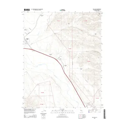
2015 Map of San Lucas
USGS Topo · Published 2015About this map
The Salinas River corridor defines this portion of Monterey County, where the agricultural flats meet the rising slopes of the Diablo Range. The settlement of King City occupies the northwest corner of the map, established as a hub for the valley's cattle and farming industries. Southward along the river, the smaller community of San Lucas and the rail-aligned site of Welby mark the transport route through the canyon-scored landscape. The area's infrastructure is anchored by the Mesa Del Rey Airport and a network of rural roads such as Cattlemen Rd and Lonoak Rd. Numerous drainages, including San Lorenzo Cr, Wildhorse Canyon, and Hamilton Canyon, cut through the eastern uplands, illustrating the complex drainage patterns that feed into the Salinas Valley. This 2015 survey provides a modern view of land divisions, from the structured grids of King City to the broad township and range sections of the outlying hills.
Find a feature on this map
33 named features on this map. Tap any name to fly to it.
Don’t see what you’re looking for? This feature index may not catch every label — zoom into the map to look around manually.
Map Details
Editions of this 2015 San Lucas Map
This is the sole edition of this map. No revisions or reprints were ever made.
Other maps of this area

1912 · San Ardo
USGS Topo · 1:31,680

1912 · Metz
USGS Topo · 1:31,680

1915 · Priest Valley
USGS Topo · 1:125,000

1919 · King City
USGS Topo · 1:62,500

1921 · Metz
USGS Topo · 1:62,500

1939 · King City
USGS Topo · 1:62,500

1940 · Metz
USGS Topo · 1:62,500

1941 · San Ardo
USGS Topo · 1:62,500

1943 · San Ardo
USGS Topo · 1:62,500

1943 · Hernandez Valley
USGS Topo · 1:62,500