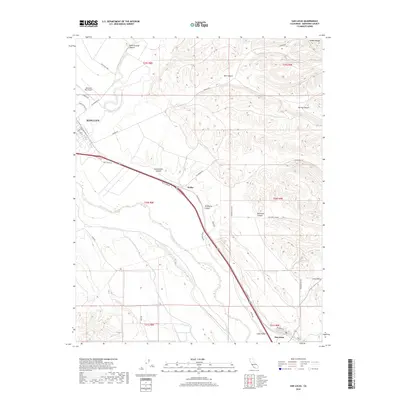
2018 Map of San Lucas
USGS Topo · Published 2018About this map
Salinas River valley agriculture and the foothills of the Diablo Range define this portion of Monterey County. The settlement of King City occupies the northwest corner, anchored by the Mesa Del Rey Airport and an industrial corridor near Industrial Way. Following the southeast trajectory of the valley, the 101 corridor passes through the small community of Welby before reaching San Lucas at the junction with Route 198. The landscape is characterized by a dramatic transition from the flat river bottom to a series of deep drainages including Wildhorse Canyon, Bull Canyon, and Hamilton Canyon. These canyons, along with Long Valley in the south, demonstrate the complex erosion patterns that have shaped the ranching and agricultural lands between the river and the higher peaks of the range.
Find a feature on this map
39 named features on this map. Tap any name to fly to it.
Don’t see what you’re looking for? This feature index may not catch every label — zoom into the map to look around manually.
Map Details
Editions of this 2018 San Lucas Map
This is the sole edition of this map. No revisions or reprints were ever made.
Other maps of this area

1912 · San Ardo
USGS Topo · 1:31,680

1912 · Metz
USGS Topo · 1:31,680

1915 · Priest Valley
USGS Topo · 1:125,000

1919 · King City
USGS Topo · 1:62,500

1921 · Metz
USGS Topo · 1:62,500

1939 · King City
USGS Topo · 1:62,500

1940 · Metz
USGS Topo · 1:62,500

1941 · San Ardo
USGS Topo · 1:62,500

1943 · San Ardo
USGS Topo · 1:62,500

1943 · Hernandez Valley
USGS Topo · 1:62,500