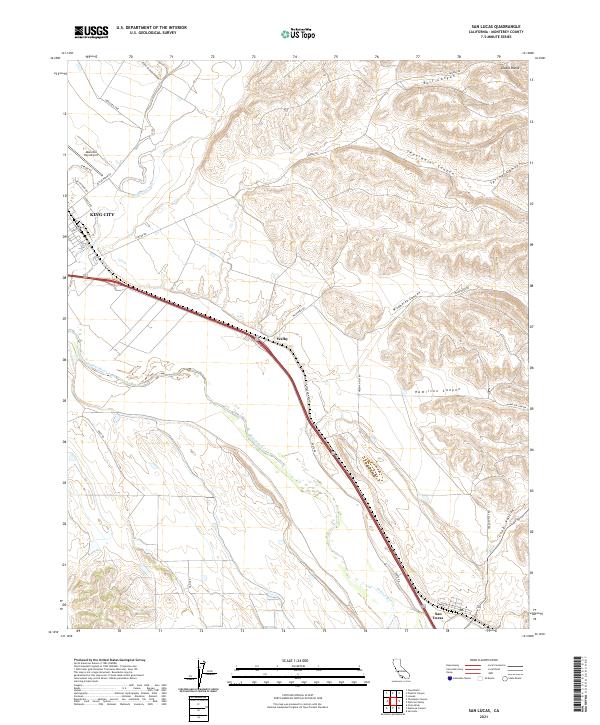
2021 Map of San Lucas
USGS Topo · Published 2021About this map
The Salinas River corridor defines this portion of Monterey County, cutting a broad path through the landscape between the Diablo Range to the northeast and the foothills to the southwest. The town of King City occupies the northwest corner of the sheet, served by the Mesa Del Rey Airport and an industrial corridor along Industrial Way. This area serves as a primary transit and agricultural hub, where the river's path is paralleled by major road networks and local routes like Lonoak Rd and Cattlemen Rd.
Find a feature on this map
37 named features on this map. Tap any name to fly to it.
Don’t see what you’re looking for? This feature index may not catch every label — zoom into the map to look around manually.
Map Details
Editions of this 2021 San Lucas Map
This is the sole edition of this map. No revisions or reprints were ever made.
Other maps of this area

1912 · San Ardo
USGS Topo · 1:31,680

1912 · Metz
USGS Topo · 1:31,680

1915 · Priest Valley
USGS Topo · 1:125,000

1919 · King City
USGS Topo · 1:62,500

1921 · Metz
USGS Topo · 1:62,500

1939 · King City
USGS Topo · 1:62,500

1940 · Metz
USGS Topo · 1:62,500

1941 · San Ardo
USGS Topo · 1:62,500

1943 · San Ardo
USGS Topo · 1:62,500

1943 · Hernandez Valley
USGS Topo · 1:62,500