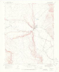
1967 Map of San Luis
USGS Topo · Published 1971About this map
San Luis, the oldest continuously inhabited town in Colorado, serves as the focal point of this 1967 survey. The landscape is defined by the intricate irrigation system of the Sangre de Cristo Grant, where traditional acequias like the San Luis Peoples Ditch and San Pedro Ditch direct water from Culebra Creek to sustain local agriculture. This network of gravity-fed waterways illustrates the communal water-sharing practices central to the region's Hispanic heritage and settlement patterns.
Find a feature on this map
28 named features on this map. Tap any name to fly to it.
Don’t see what you’re looking for? This feature index may not catch every label — zoom into the map to look around manually.
Map Details
Editions of this 1967 San Luis Map
4 editions found
Other maps of this area

1954 · Trinidad
USGS Topo · 1:250,000

1955 · Trinidad
USGS Topo · 1:250,000

1958 · Trinidad
USGS Topo · 1:250,000

1959 · Trinidad
USGS Topo · 1:250,000

1965 · Blanca SE
USGS Topo · 1:24,000

1967 · San Luis
USGS Topo · 1:24,000

1967 · La Valley
USGS Topo · 1:24,000

1967 · Fort Garland SW
USGS Topo · 1:24,000

1967 · Ojito Peak
USGS Topo · 1:24,000

1967 · Taylor Ranch
USGS Topo · 1:24,000