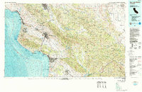
1981 Map of San Luis Obispo
USGS Topo · Published 1988About this map
The Santa Lucia Range and Los Padres National Forest dominate this coastal landscape, providing a sharp topographic contrast to the developed corridors around San Luis Obispo and the Five Cities area. This topographic-bathymetric study captures the Central Coast during a period of established growth, showing the intricate relationship between the Southern Pacific Railroad and the coastal settlements of Morro Bay and Pismo Beach.
Find a feature on this map
62 named features on this map. Tap any name to fly to it.
Don’t see what you’re looking for? This feature index may not catch every label — zoom into the map to look around manually.
Map Details
Editions of this 1981 San Luis Obispo Map
3 editions found
Other maps of this area

1897 · Port Harford
USGS Topo · 1:62,500

1897 · San Luis Obispo
USGS Topo · 1:62,500

1897 · Cayucos
USGS Topo · 1:62,500

1897 · Arroyo Grande
USGS Topo · 1:62,500

1900 · San Luis
USGS Topo · 1:125,000

1902 · Santa Ynez
USGS Topo · 1:125,000

1905 · Guadalupe
USGS Topo · 1:125,000

1905 · Santa Ynez
USGS Topo · 1:125,000

1905 · Lompoc
USGS Topo · 1:125,000

1912 · McKittrick
USGS Topo · 1:125,000