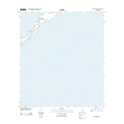
2013 Map of San Luis Pass
USGS Topo · Published 2013About this map
Galveston Island terminates at the southwestern edge of this survey, where the narrow landmass meets the waters of the Gulf of Mexico. This coastal corridor is defined by the transition between the open sea and the protected reaches of West Bay, connected via the natural inlet at San Luis Pass. The landscape illustrates a concentrated pocket of coastal development along San Luis Pass Rd, characterized by residential street networks like Bay Breeze Dr and Estuary Dr that overlook Red Fish Cove. This modern era representation shows the precise shoreline and road infrastructure of the island's western tip, serving as a reference for the coastal geography of the Texas Gulf Coast as it appeared in the early 21st century.
Find a feature on this map
10 named features on this map. Tap any name to fly to it.
Don’t see what you’re looking for? This feature index may not catch every label — zoom into the map to look around manually.
Map Details
Editions of this 2013 San Luis Pass Map
This is the sole edition of this map. No revisions or reprints were ever made.
Other maps of this area

1929 · Karankawa Lake
USGS Topo · 1:24,000

1931 · Lake Como
USGS Topo · 1:24,000

1933 · Karankawa Lake
USGS Topo · 1:31,680

1933 · San Luis Pass
USGS Topo · 1:31,680
1933 · Lake Como
USGS Topo · 1:31,680

1943 · San Luis Pass
USGS Topo · 1:31,680
1943 · Lake Como
USGS Topo · 1:25,000
1943 · Carancahua Lake
USGS Topo · 1:24,000

1943 · Christmas Point
USGS Topo · 1:24,000

1943 · Chocolate Bay
USGS Topo · 1:24,000