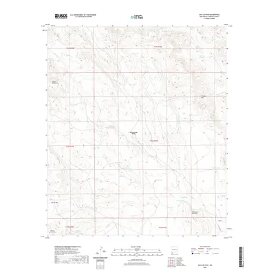
2020 Map of San Luis Pass
USGS Topo · Published 2020About this map
Deer Creek Wells serves as a focal point in this high-desert region of Hidalgo County, where water management is the primary signature of human activity. The landscape is defined by an extensive system of catchment features including Big Geronimo Tank, Little Geronimo Tank, and Malpais Tank, highlighting the vital importance of water security for ranching in the arid Southwest. This topography is framed by the Animas Mountains to the west and the Whitewater Mountains to the east, with San Luis Pass providing a natural corridor through the San Luis Mountains. Numerous ephemeral drainages like Eicks Draw, Aiken Draw, and Lynch Draw carve through the basin, illustrating the complex natural irrigation patterns that dictate the placement of local landmarks and infrastructure in this borderland territory.
Find a feature on this map
46 named features on this map. Tap any name to fly to it.
Don’t see what you’re looking for? This feature index may not catch every label — zoom into the map to look around manually.
Map Details
Editions of this 2020 San Luis Pass Map
This is the sole edition of this map. No revisions or reprints were ever made.
Other maps of this area

1917 · Antelope Wells
USGS Topo · 1:62,500

1918 · Walnut Wells
USGS Topo · 1:62,500

1918 · Cienega Springs
USGS Topo · 1:62,500

1918 · Animas Peak
USGS Topo · 1:62,500

1919 · Antelope Wells
USGS Topo · 1:62,500

1920 · Animas Peak
USGS Topo · 1:62,500

1923 · Walnut Wells
USGS Topo · 1:62,500

1955 · Douglas
USGS Topo · 1:250,000

1959 · Douglas
USGS Topo · 1:250,000

1961 · Douglas
USGS Topo · 1:250,000