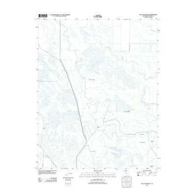
2012 Map of San Luis Ranch
USGS Topo · Published 2012About this map
San Luis Island dominates this portion of the San Joaquin Valley, defined by a complex network of wetlands and hydraulic engineering. The San Joaquin River winds along the eastern boundary, while the interior is marked by numerous waterways including Deadmans Slough and Deep Slough. The landscape reflects a transition from natural riverine features like Big Buttonwillow Lake to a highly managed agricultural environment. Major infrastructure such as the San Luis Canal and the Santa Fe Grade support the local ranching economy. Named agricultural outposts, including Exeter Farms, Hereford Ranch, and the San Luis Ranch, are situated amidst an intricate system of lateral drains and canals like Island Canal D and the West Delta Drain.
Find a feature on this map
27 named features on this map. Tap any name to fly to it.
Don’t see what you’re looking for? This feature index may not catch every label — zoom into the map to look around manually.
Map Details
Editions of this 2012 San Luis Ranch Map
This is the sole edition of this map. No revisions or reprints were ever made.
Other maps of this area

1916 · Delta Ranch
USGS Topo · 1:24,000

1918 · Arena
USGS Topo · 1:31,680

1918 · Stevinson
USGS Topo · 1:31,680

1918 · Gustine
USGS Topo · 1:31,680

1918 · Turner Ranch
USGS Topo · 1:31,680

1919 · San Luis Ranch
USGS Topo · 1:31,680

1919 · Ingomar
USGS Topo · 1:31,680

1921 · Volta
USGS Topo · 1:31,680

1921 · Los Banos
USGS Topo · 1:31,680
1922 · Delta Ranch
USGS Topo · 1:31,680