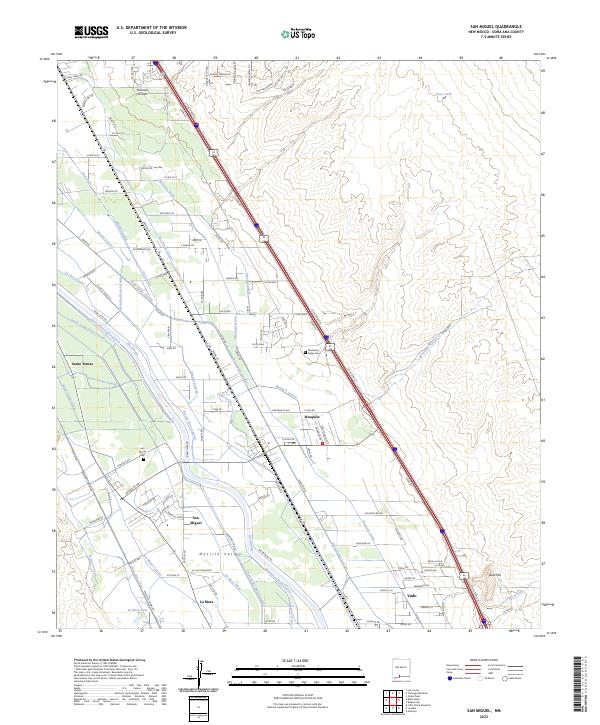
2023 Map of San Miguel
USGS Topo · Published 2023About this map
The Mesilla Valley defines this agricultural corridor south of Las Cruces, where the Rio Grande sustains a complex network of irrigation infrastructure. This landscape is a patchwork of communal water management, characterized by an intricate system of channels including the Chamberino Main Lateral, Brazito Lateral, and Three Saints Lateral. These waterways support a string of settlements like San Miguel, Mesquite, and Santo Tomas, which are connected by historic routes and modern infrastructure like US Highway 85 180.
Find a feature on this map
127 named features on this map. Tap any name to fly to it.
Don’t see what you’re looking for? This feature index may not catch every label — zoom into the map to look around manually.
Map Details
Editions of this 2023 San Miguel Map
This is the sole edition of this map. No revisions or reprints were ever made.
Other maps of this area

1891 · Las Cruces
USGS Topo · 1:125,000

1893 · Las Cruces
USGS Topo · 1:125,000

1941 · Las Cruces
USGS Topo · 1:62,500

1941 · Organ Peak
USGS Topo · 1:62,500

1943 · La Mesa
USGS Topo · 1:62,500

1943 · Organ Peak
USGS Topo · 1:62,500

1943 · Afton
USGS Topo · 1:62,500

1943 · Las Cruces
USGS Topo · 1:62,500
1955 · Tortugas Mountain
USGS Topo · 1:24,000
1955 · Bishop Cap
USGS Topo · 1:24,000