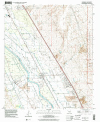
1996 Map of San Miguel
USGS Topo · Published 2002About this map
San Miguel and its neighboring agricultural colonies define the landscape of the Mesilla Valley in this late-twentieth-century study. The Rio Grande serves as the central artery for a complex network of irrigation channels, including the Mesilla Drain and Chamberino Main Lateral, which support the historic settlements of Santo Tomas, Mesquite, and La Mesa. These communities are rooted in traditional land divisions such as the Santo Tomas de Yturbide Colony and Bend Colony, reflecting the region's deep Hispanic heritage and agrarian foundations.
Find a feature on this map
41 named features on this map. Tap any name to fly to it.
Don’t see what you’re looking for? This feature index may not catch every label — zoom into the map to look around manually.
Map Details
Editions of this 1996 San Miguel Map
This is the sole edition of this map. No revisions or reprints were ever made.
Other maps of this area

1891 · Las Cruces
USGS Topo · 1:125,000

1893 · Las Cruces
USGS Topo · 1:125,000

1941 · Las Cruces
USGS Topo · 1:62,500

1941 · Organ Peak
USGS Topo · 1:62,500

1943 · La Mesa
USGS Topo · 1:62,500

1943 · Organ Peak
USGS Topo · 1:62,500

1943 · Afton
USGS Topo · 1:62,500

1943 · Las Cruces
USGS Topo · 1:62,500
1955 · Tortugas Mountain
USGS Topo · 1:24,000
1955 · Bishop Cap
USGS Topo · 1:24,000