
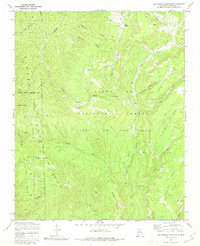
1970 Map of San Miguel Mountain
USGS Topo · Published 1973About this map
Giant Footprint Ruins and other scattered archaeological sites punctuate this high-altitude landscape within the Santa Fe National Forest. The map documents a complex intersection of land jurisdictions, showing the meeting points of the Jemez Indian Reservation, the Cañon de San Diego Grant, and the Ojo del Espiritu Santo Grant. Small outposts like O'Neil Landing and Porter sit along the narrow valleys carved by the Rio de las Vacas and Rio Guadalupe. The terrain is characterized by massive, flat-topped formations including Schoolhouse Mesa and Stable Mesa, accessed only by a network of primitive trails and jeep trails. Named springs such as Bear Springs and Stable Spring indicate the critical water sources that once supported the small settlements and seasonal grazing in these canyons.
Find a feature on this map
43 named features on this map. Tap any name to fly to it.
Don’t see what you’re looking for? This feature index may not catch every label — zoom into the map to look around manually.
Map Details
Editions of this 1970 San Miguel Mountain Map
2 editions found
Other maps of this area

1890 · Jemes
USGS Topo · 1:125,000

1892 · Jemes
USGS Topo · 1:125,000

1937 · Jemez Springs
USGS Topo · 1:48,000

1939 · La Ventana
USGS Topo · 1:62,500

1939 · San Ysidro
USGS Topo · 1:62,500

1943 · San Ysidro
USGS Topo · 1:62,500

1943 · Jemez
USGS Topo · 1:62,500

1943 · La Ventana
USGS Topo · 1:62,500

1944 · Jemez Springs
USGS Topo · 1:62,500

1952 · Jemez Springs
USGS Topo · 1:62,500