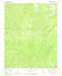
1970 Map of San Miguel Mountain
USGS Topo · Published 1980About this map
San Miguel Mountain dominates the high-altitude landscape of Sandoval County within the Santa Fe National Forest. This 1970 field-checked survey reveals a rugged geography defined by expansive flat-topped mesas, including Schoolhouse Mesa and Stable Mesa, deeply carved by drainage systems like Bales Canyon and Joaquin Canyon. The map provides significant archaeological and historical detail, marking the locations of Ruins and the specifically named Giant Footprint Ruins in the southeast. Land tenure is a central theme here, with several major boundaries intersecting, including the Jemez Pueblo Indian Reservation and the Espiritu Santo Grant Bdy. Small outposts such as Porter and O'Neil Landing are documented along the watercourses of Las Vacas and Rito Cebolla, providing evidence of mid-century forest activity and remote mountain commerce.
Find a feature on this map
41 named features on this map. Tap any name to fly to it.
Don’t see what you’re looking for? This feature index may not catch every label — zoom into the map to look around manually.
Map Details
Editions of this 1970 San Miguel Mountain Map
2 editions found

Other maps of this area

1890 · Jemes
USGS Topo · 1:125,000

1892 · Jemes
USGS Topo · 1:125,000

1937 · Jemez Springs
USGS Topo · 1:48,000

1939 · La Ventana
USGS Topo · 1:62,500

1939 · San Ysidro
USGS Topo · 1:62,500

1943 · San Ysidro
USGS Topo · 1:62,500

1943 · Jemez
USGS Topo · 1:62,500

1943 · La Ventana
USGS Topo · 1:62,500

1944 · Jemez Springs
USGS Topo · 1:62,500

1952 · Jemez Springs
USGS Topo · 1:62,500