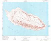
1956 Map of San Nicolas Island
USGS Topo · Published 1980About this map
San Nicolas Island is depicted here in detail following mid-century field checks and aerial photography. As the most remote of California's Channel Islands, the landscape is defined by its isolation within the Pacific Ocean. This 1:24,000 scale survey illustrates the island's unique topography, including the sheltered waters of Dutch Harbor on the southern shore and the primary navigational Light positioned on the eastern point. The map reveals the infrastructure of the era, showing a network of unimproved roads and an airfield that highlight the island's strategic utility and restricted access. The elevation contours provide a clear picture of the plateaus and steep coastal cliffs that have historically sheltered both indigenous inhabitants and later maritime operations.
Find a feature on this map
4 named features on this map. Tap any name to fly to it.
Don’t see what you’re looking for? This feature index may not catch every label — zoom into the map to look around manually.
Map Details
Editions of this 1956 San Nicolas Island Map
3 editions found
Other maps of this area
1943 · San Nicolas Island
USGS Topo · 1:24,000

1949 · Long Beach
USGS Topo · 1:250,000
1956 · San Nicolas Island
USGS Topo · 1:24,000

1957 · Long Beach
USGS Topo · 1:250,000

1958 · Long Beach
USGS Topo · 1:250,000

1960 · Long Beach
USGS Topo · 1:250,000
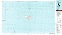
1993 · San Nicolas Island
USGS Topo · 1:100,000
2012 · San Nicolas Island OE NW
USGS Topo · 1:24,000
2012 · San Nicolas Island
USGS Topo · 1:24,000
2012 · San Nicolas Island OE N
USGS Topo · 1:24,000