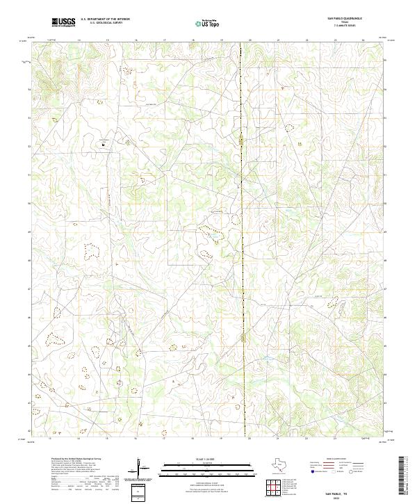
2022 Map of San Pablo
USGS Topo · Published 2022About this map
Loma Blanca rises above the South Texas brush country along the border of Webb and Duval Counties, serving as a primary landmark in this ranching landscape. The area is defined by a network of seasonal watercourses, most notably Macho Cr and the winding Santonino Cr, which drain toward the east. Human presence is centered on historical landholdings and cattle operations, evidenced by the Loma Blanca Cem and man-made water features such as Upper Field Tank and Presa Seca Tank.
Find a feature on this map
15 named features on this map. Tap any name to fly to it.
Don’t see what you’re looking for? This feature index may not catch every label — zoom into the map to look around manually.
Map Details
Editions of this 2022 San Pablo Map
This is the sole edition of this map. No revisions or reprints were ever made.
Other maps of this area

1939 · Bruni
USGS Topo · 1:62,500

1956 · Laredo
USGS Topo · 1:250,000

1967 · Hebbronville NW
USGS Topo · 1:24,000

1968 · Parrilla Creek SW
USGS Topo · 1:24,000
1968 · Mills Bennett SW
USGS Topo · 1:24,000

1968 · Mills Bennett
USGS Topo · 1:24,000

1968 · Parrilla Creek NW
USGS Topo · 1:24,000

1968 · Mills Bennett NW
USGS Topo · 1:24,000

1968 · San Pablo
USGS Topo · 1:24,000
1972 · Bruni
USGS Topo · 1:24,000