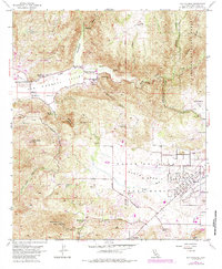
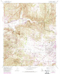
1954 Map of San Pasqual
USGS Topo · Published 1984About this map
San Pasqual Valley and the Santa Maria Valley dominate this mid-century landscape in San Diego County. The map details a period of transition, where traditional ranching and rural infrastructure, such as the Fenton Ranch and Ramona Guard Sta, exist alongside the developing footprint of the San Diego Wild Animal Park. Commemorative and educational sites are established near the Santa Ysabel Creek corridor, including the San Pasqual Battlefield State Historical Monument and the San Pasqual Union Sch.
Find a feature on this map
42 named features on this map. Tap any name to fly to it.
Don’t see what you’re looking for? This feature index may not catch every label — zoom into the map to look around manually.
Map Details
Editions of this 1954 San Pasqual Map
5 editions found
Other maps of this area

1893 · El Cajon
USGS Topo · 1:62,500

1893 · Escondido
USGS Topo · 1:62,500

1901 · Elcajon
USGS Topo · 1:62,500

1901 · Escondido
USGS Topo · 1:62,500

1901 · San Luis Rey
USGS Topo · 1:125,000

1903 · Cuyamaca
USGS Topo · 1:125,000

1903 · La Jolla
USGS Topo · 1:62,500

1903 · Elcajon
USGS Topo · 1:62,500

1903 · Ramona
USGS Topo · 1:125,000

1904 · Southern California Sheet No. 2
USGS Topo · 1:250,000