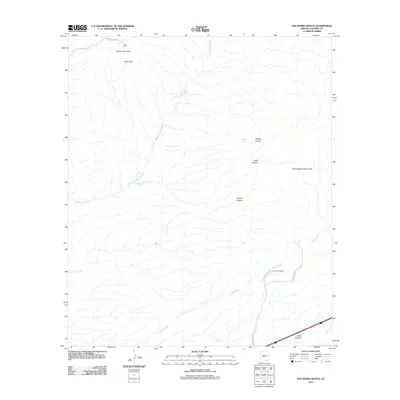
2011 Map of San Pedro Ranch
USGS Topo · Published 2011About this map
Johnny Lyon Hills and the western slopes of the Little Dragoon Mountains dominate this Cochise County landscape in the early 21st century. The map provides a clear view of the complex drainage systems defined by Tres Alamos Wash and Sheep Wash, which carve through the arid terrain. Working ranching operations remain central to the area's identity, evidenced by the San Pedro Ranch and Keith Ranch, the latter of which sits near the prominence of Keith Peak. Access to these interior reaches is maintained by a network of ranch roads including E Keith Ranch Rd and N San Pedro Ranch Rd. To the south, the terrain descends toward Texas Canyon, showing how physical landmarks and long-established land holdings continue to shape the geography of the San Pedro River Valley region.
Find a feature on this map
14 named features on this map. Tap any name to fly to it.
Don’t see what you’re looking for? This feature index may not catch every label — zoom into the map to look around manually.
Map Details
Editions of this 2011 San Pedro Ranch Map
This is the sole edition of this map. No revisions or reprints were ever made.
Other maps of this area

1915 · Benson
USGS Topo · 1:125,000

1922 · St. David
USGS Topo · 1:62,500

1926 · Whetstone
USGS Topo · 1:62,500

1943 · Benson
USGS Topo · 1:125,000

1943 · Dragoon
USGS Topo · 1:62,500

1945 · Happy Valley
USGS Topo · 1:62,500

1956 · Nogales
USGS Topo · 1:250,000

1956 · Tucson
USGS Topo · 1:250,000

1958 · Nogales
USGS Topo · 1:250,000

1958 · Tucson
USGS Topo · 1:250,000